Here you will find the some of the favorite national parks located on Tortola British Virgin Islands.
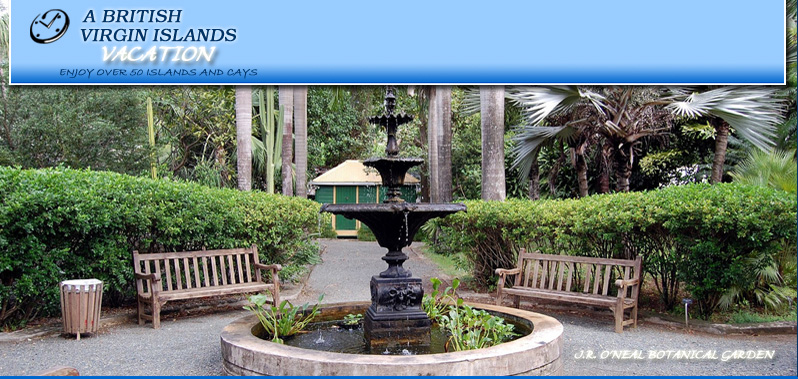
Joseph Reynold O'Neal Botantical Garden
(located in Road Town, Tortola)
At the site of a century old Agriculture Experiment Station, The Botanic Gardens are a beautiful oasis in the center of Road Town. The park is named after Mr Joseph Reynold O'Neal who was a leading figure in the formation of the National Parks Trust and establishing the BVI's first national park named Mt. Sage National Park. The botanic collections represent the different habitats across the British Virgin Islands. A gazebo of orchids both native and exotic can be discovered by the pond, where lilies float and tortoises swim.
click thumbnail to enlarge (photo of the JR O'Neal Botantical Garden, British Virgin Islands)


details of J.R. O'Neal Natoinal Park, Tortola British Virgin Islands
Sage Mountain National Park
Eastablished in 1964 : 86 acres
As the first National Park in the BVI Sage Mountain represents the beginning of conservation in the territory. Through a generous donation from Laurance Rockerfeller, The Land at Sage Mountain was purchased from farmers and given to the BVI Government as a National Park. The Farmland was reforested with white cedar West Indian and Honduran mahogany trees which have thrived along with other naturally regenerated secondary vegetation. Sage Mountain is the highest point in the British and US Virgin Islands at 1716 feet with panoramic views of all the islands. The mountain itself creates rain as warm moist air rises from the east and south, then cools as it crosses the mountain. This falls as rain on the northern side of the Park, which is reflected in the different types of vegetation that are found on the north and south sides of the ridge.
The main entrance of the park is a 5-minute walk from the car park. There are twelve trails through the forest with loops creating circular route. Brochures are available at the Park entrance.
click thumbnail to enlarge (photo of Sage Mountain National Park, British Virgin Islands)

detaisl of Mount Sage National Park, Tortola, British Virgin Islands
Mount Healthy National Park
(located on Tortola, BVI)
An 18th century windmill that was once used for grinding the sugarcane, farmed from the steep slopes of the north shore of Tortola. This was once part of a thriving 250 acre plantation where enslaved Africans cultivated the sugarcane on the terraced slopes and processed it into sugar which was then shipped to Britian for sale. Across the road from the the windmill lie the ruins of the mill round, which was powered by animals, the factory with boiling house, the distiller, hospital and living quarters.
Mount Healthy windmill is the last remaining windmill in the BVI and was constructed from field rubble. The large arched apertures are accented by cut stone blocks. These functional openings were used for carrying the sugar cane in stone blocks. These functional openings were used for carrying the sugar cane into the mill for grinding and crushed can (bagasse) out. The ciruclar walls of the windmill were often six or more feet at the base, tapering up to three feet at the top to a truncated cone.
Following the abolition of enslavement in 1834, workers from the Mt.Healthy estate could buy land to cultivate for themselves. However the sugar industry deteriorated after a series of disastrous hurricanes in the 1830's and drought in the 1850s, resulting in the windmill becoming a relic.
click thumbnail to enlarge (photos of Mount Healthy National Park, British Virgin Islands)

detaisl of Mount Healthy National Park, Tortola, British Virgin Islands


